THE EAST JUTLAND MILLION CITY

THE EAST JUTLAND MILLION CITY
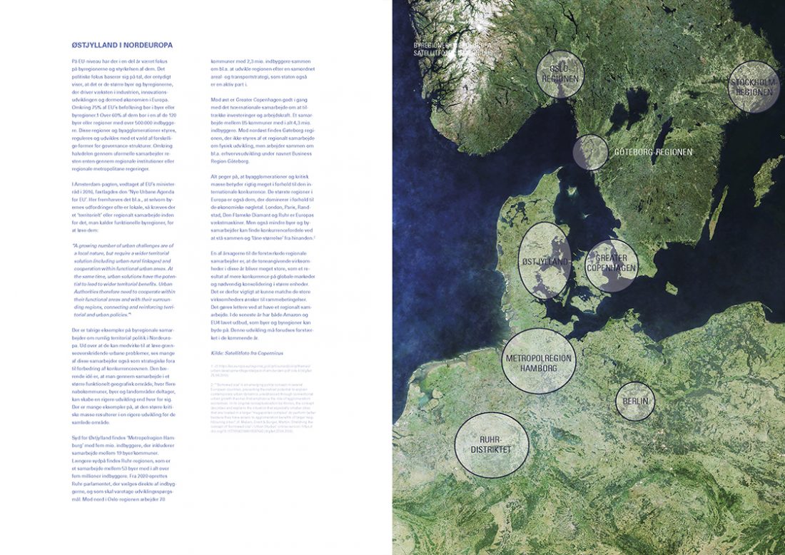
An atlas with maps, demographics and other data material for the East Jutland Million City developed in connection with the development project ‘A Structural Image of Eastern Jutland’. The material forms the basis of the project’s preliminary analyses and scenarios, which are available here. The primary sources are maps and the data from the Agency for Data Supply and Efficiency, Plandata.dk, Arealinfo.dk and Statistics Denmark. Additional material includes data and maps kindly made available by Banedanmark, the Danish Road Directorate, the Knowledge Centre for Housing Economics, DREAM and EnergiNET. Finally, Statistics Denmark and DREAM have carried out bespoke data searches and analyses for the project. The project group has received assistance with the updated commuter analysis from MSc Thomas Sick Nielsen.
The atlas of the East Jutland Million City contains three parts:
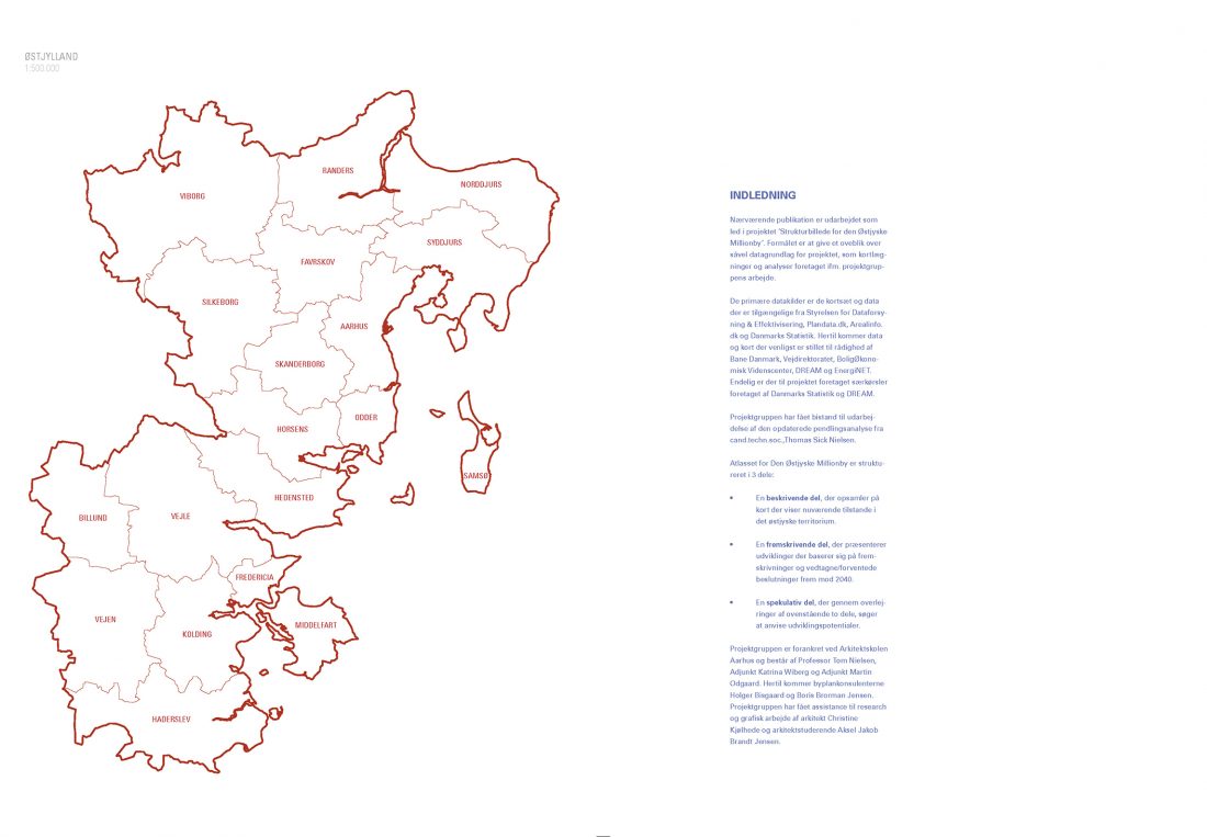
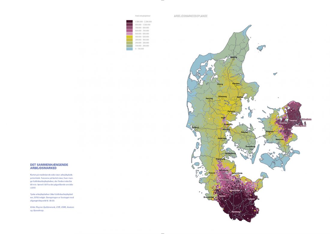
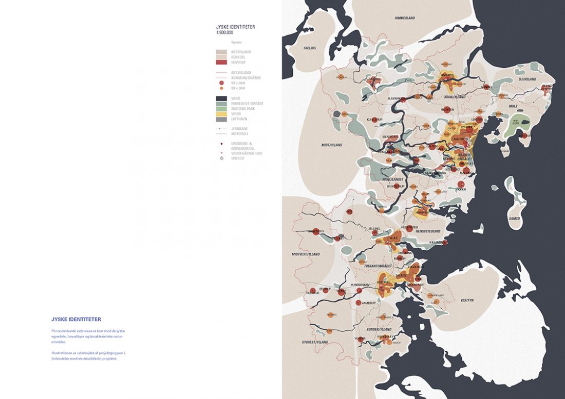
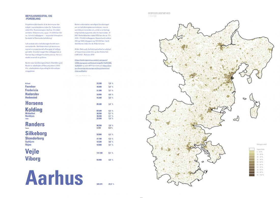
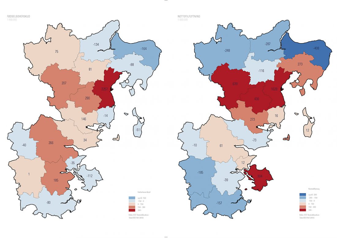
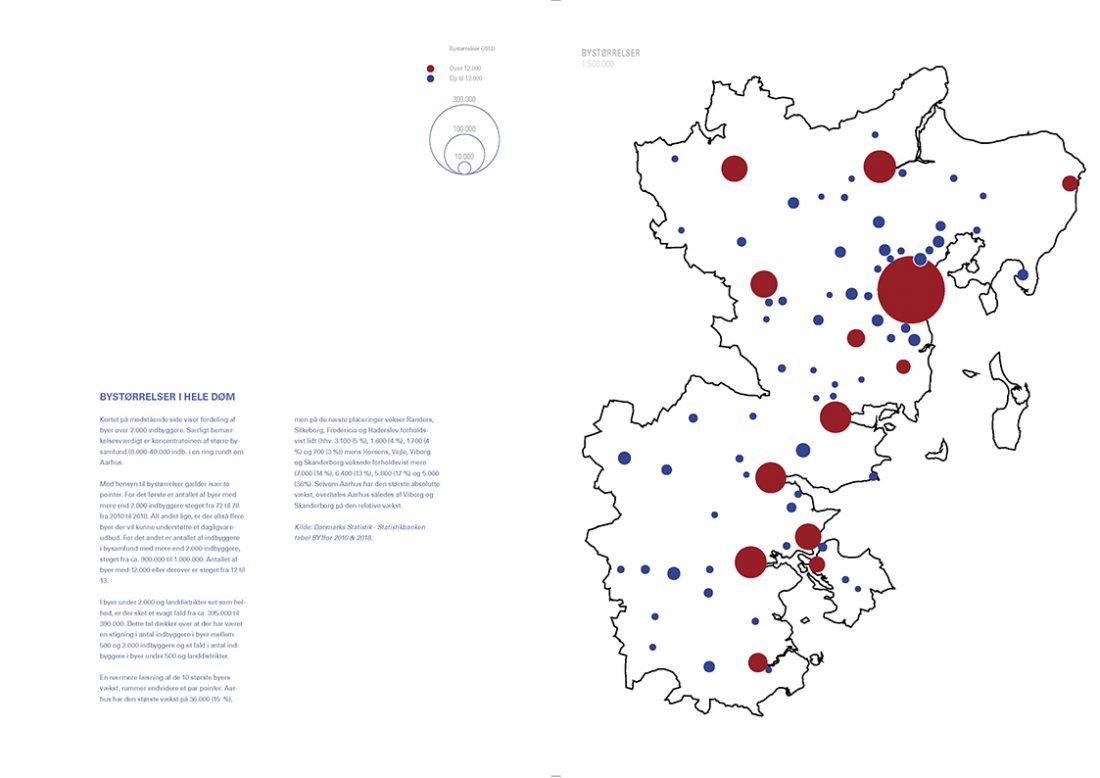
1) A descriptive part with maps of nature areas, infrastructure, built developments and so forth as well as illustrations of demographic developments, income distribution, commuter patterns and so forth.
2) A projective part that illustrates different developmental patterns and trends based on projections and actual or predicted/expected decisions between now and 2040.
3) A speculative part that shows territorial consequences of anticipated climate changes between now and 2040.
The atlas is available in electronic form (only in Danish) from bbj@borisbrorman.dk
Date
05/12 2019
Category
Debate, Publications