DEVELOPING A STRUCTURAL IMAGE OF EAST JUTLAND
DEVELOPING A STRUCTURAL IMAGE OF EAST JUTLAND
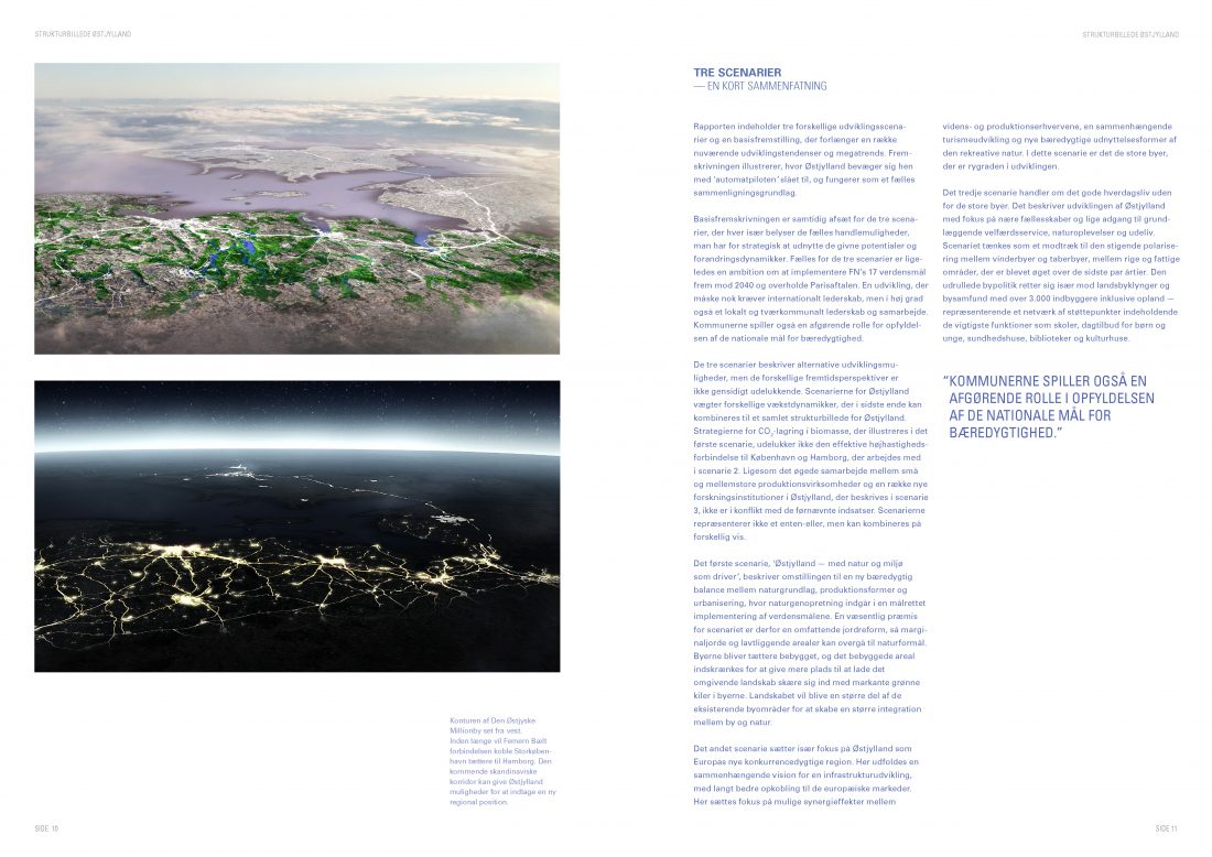
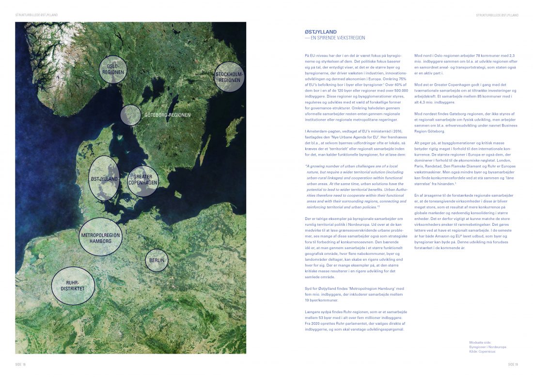
The report summarizes (in danish) insights and recommendations from a development project funded by Realdania aimed at developing an overall structural image of East Jutland. A structural image that is intended to inform a coherent long-term regional development strategy for East Jutland – from Randers in the north to Haderslev in the south. The primary aim of the report is to initiate the necessary debate and to bring the municipalities in East Jutland together around a common agenda for a possible collaboration that can hopefully lead to an actual strategic development plan for East Jutland: a future-proof regional urbanization of the East Jutland Million City that respects the area’s unique natural and landscape values.
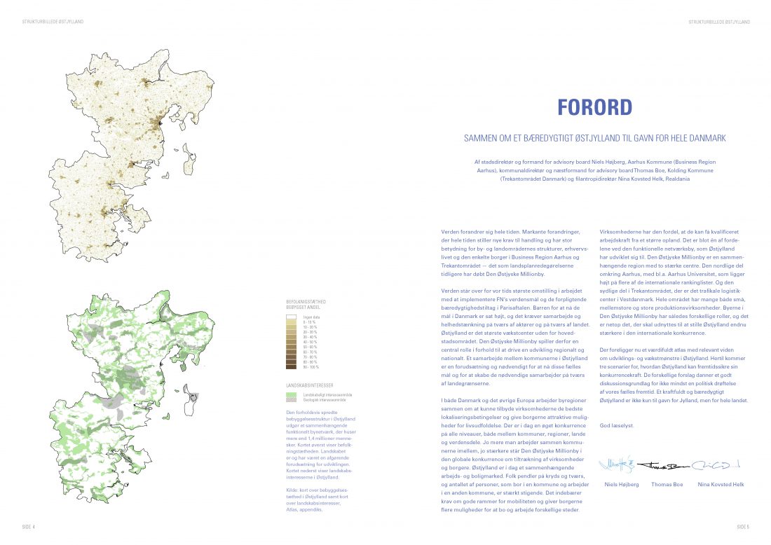
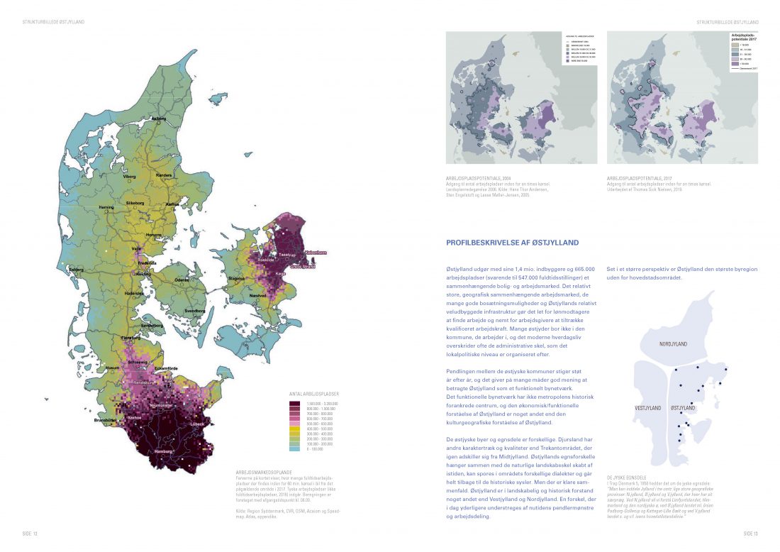
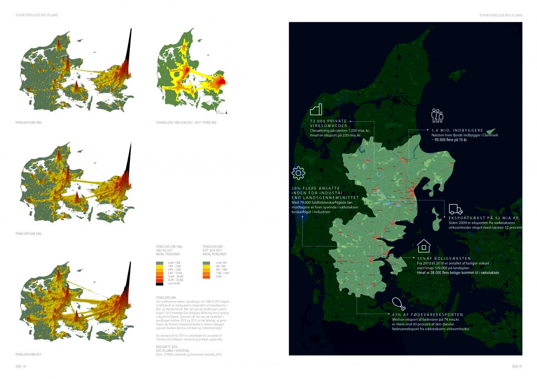
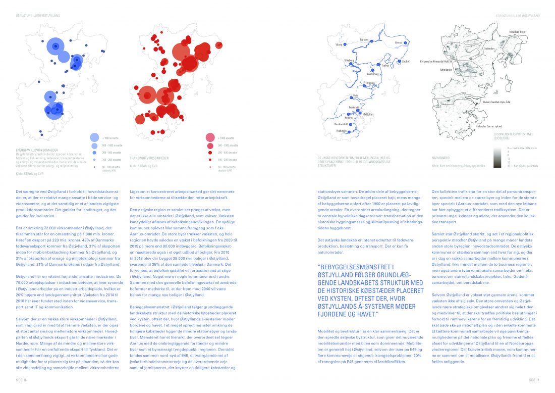
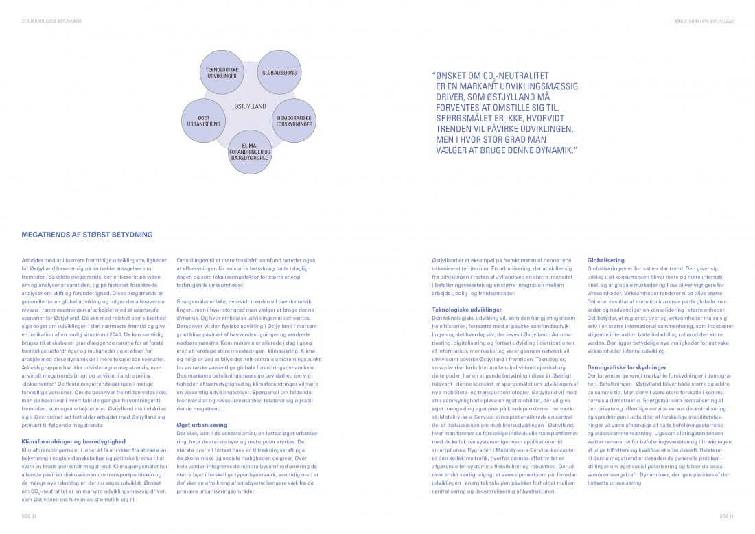
The material was presented to 19 municipalities in East Jutland at a conference in December 2019. In addition to a simple future projection based on the present situation, the report outlines three scenarios for a sustainable development of East Jutland until 2040. The projection illustrates where East Jutland is headed if it continues ‘on autopilot’. This projection is intended as a common basis of comparison for the three scenarios, which outline different directions and paths of development and growth dynamics, all driven by an ambition of implementing the United Nations’ 17 Sustainable Development Goals and realizing the Paris Agreement. The underlying analyses and scenarios rely on data from a comprehensive atlas of the East Jutland Million City developed by the project group. You can see the atlas here.
Download a full-text version of the report (in Danish) as a pdf.
Date
05/12 2019
Category
Debate, Publications